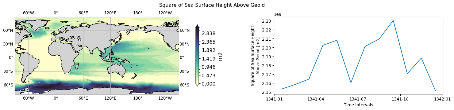
ocean: 2D#
2D ocean data
coordinate(s):
tavg-u-hxy-sea
tavg-u-hxy-ifs
tmax-u-hxy-sea
tmin-u-hxy-sea
tavg-d300m-hxy-sea
tavg-d700m-hxy-sea
tavg-d2000m-hxy-sea
tavg: time average
u: ocean surface
d300m: layer at 300m depth
d700m: layer at 700m depth
d2000m: layer at 2000m depth
hxy: horizontal curvlinear grids
sea: ocean domain
# Parameters
cmorout = "/scratch/yanchun/cmorout"
source_id = "UKESM1-0-LL"
experiment_id = "piControl"
variant_label = "r1i1p1f1"
grid_label = "g99"
version = "v20260617"
List of datasets:
(datasets which are not presented/cmorized have no link.)
Datasets validated:
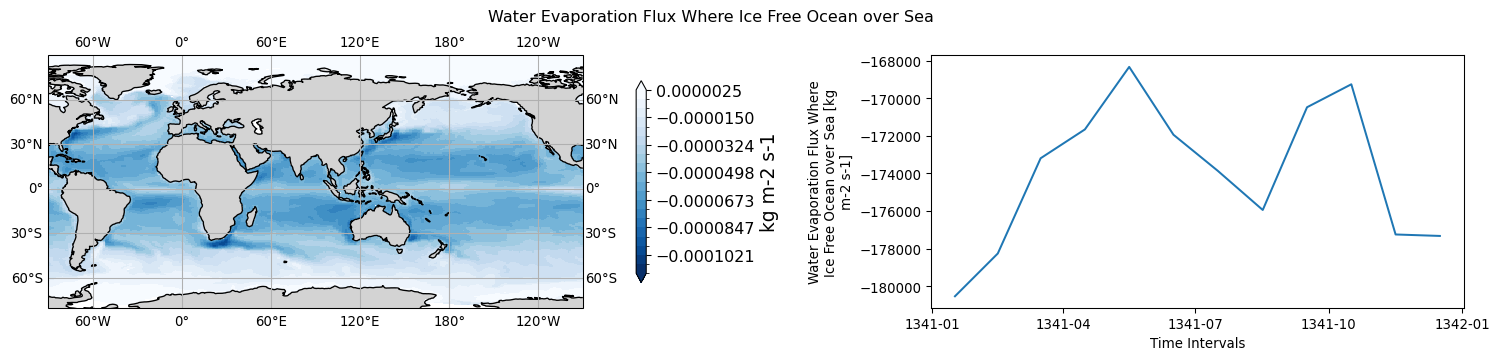
ocean.evspsbl.tavg-u-hxy-ifs.mon.glb
long name: Water Evaporation Flux Where Ice Free Ocean over Sea (kg m-2 s-1)
timeseries aggregation method for 3D->1D plot: mean
NorESM->CMOR: eva -> evspsbl
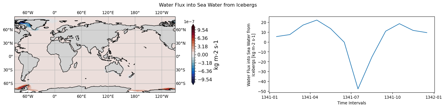
ocean.ficeberg.tavg-u-hxy-sea.mon.glb
long name: Water Flux into Sea Water from Icebergs (kg m-2 s-1)
timeseries aggregation method for 3D->1D plot: mean
NorESM->CMOR: rfi -> ficeberg
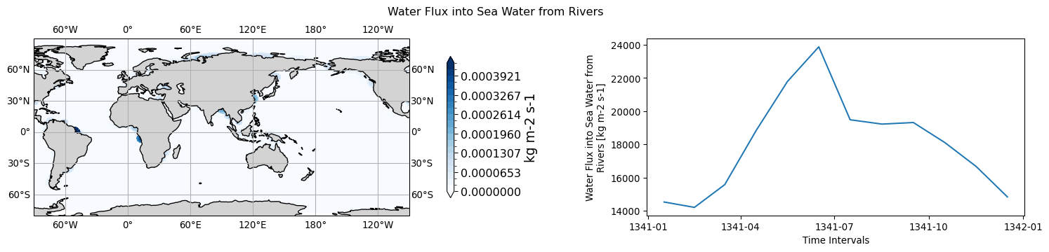
ocean.friver.tavg-u-hxy-sea.mon.glb
long name: Water Flux into Sea Water from Rivers (kg m-2 s-1)
timeseries aggregation method for 3D->1D plot: mean
NorESM->CMOR: rnf -> friver
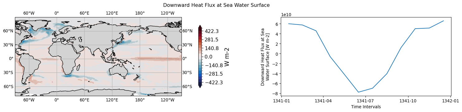
ocean.hfds.tavg-u-hxy-sea.mon.glb
long name: Downward Heat Flux at Sea Water Surface (W m-2)
timeseries aggregation method for 3D->1D plot: mean
NorESM->CMOR: hflx -> hfds
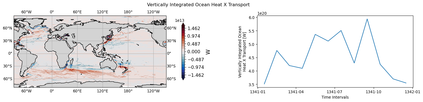
ocean.hfx.tavg-u-hxy-sea.mon.glb
long name: Vertically Integrated Ocean Heat X Transport (W)
timeseries aggregation method for 3D->1D plot: mean
NorESM->CMOR: uhflx, dp -> hfx
history: hfx = vertical average by dp, sum(uhflx*dp)/sum(dp)
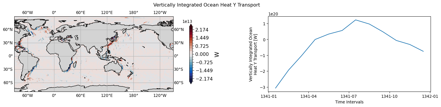
ocean.hfy.tavg-u-hxy-sea.mon.glb
long name: Vertically Integrated Ocean Heat Y Transport (W)
timeseries aggregation method for 3D->1D plot: mean
NorESM->CMOR: vhflx, dp -> hfy
history: hfy = vertical average by dp, sum(vhflx*dp)/sum(dp)
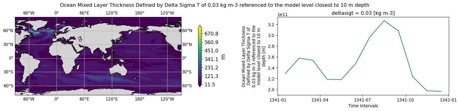
ocean.mlotst.tavg-u-hxy-sea.day.glb
long name: Ocean Mixed Layer Thickness Defined by Delta Sigma T of 0.03 kg m-3 referenced to the model level closest to 10 m depth (m)
timeseries aggregation method for 3D->1D plot: mean
NorESM->CMOR: mldb04 -> mlotst
history: 2026-06-17T11:50:23Z altered by CMOR: Treated scalar dimension: 'deltasigt'.
ocean.mlotst.tavg-u-hxy-sea.mon.glb
long name: Ocean Mixed Layer Thickness Defined by Delta Sigma T of 0.03 kg m-3 referenced to the model level closest to 10 m depth (m)
timeseries aggregation method for 3D->1D plot: mean
NorESM->CMOR: mldb04 -> mlotst
history: 2026-06-17T11:50:23Z altered by CMOR: Treated scalar dimension: 'deltasigt'.
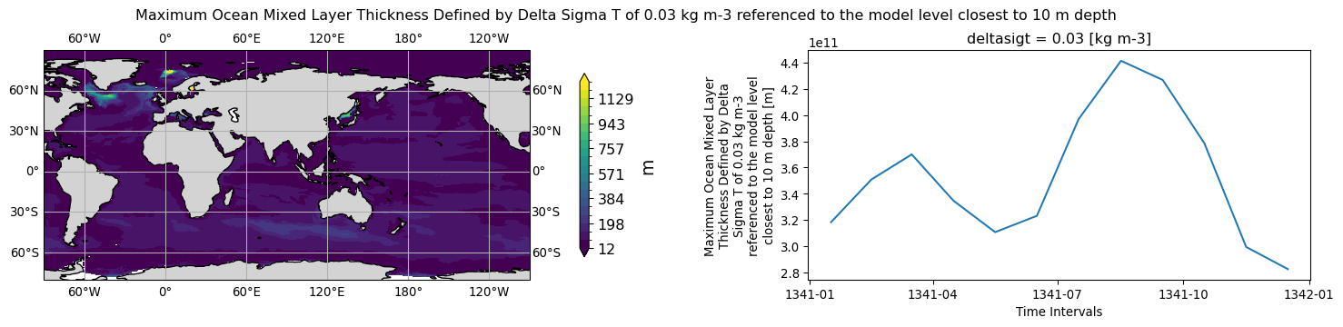
ocean.mlotst.tmax-u-hxy-sea.mon.glb
long name: Maximum Ocean Mixed Layer Thickness Defined by Delta Sigma T of 0.03 kg m-3 referenced to the model level closest to 10 m depth (m)
timeseries aggregation method for 3D->1D plot: mean
NorESM->CMOR: mldb04mx -> mlotst
history: 2026-06-17T11:50:23Z altered by CMOR: Treated scalar dimension: 'deltasigt'.
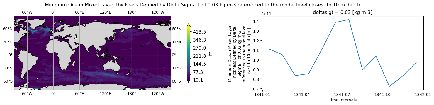
ocean.mlotst.tmin-u-hxy-sea.mon.glb
long name: Minimum Ocean Mixed Layer Thickness Defined by Delta Sigma T of 0.03 kg m-3 referenced to the model level closest to 10 m depth (m)
timeseries aggregation method for 3D->1D plot: mean
NorESM->CMOR: mldb04mn -> mlotst
history: 2026-06-17T11:50:25Z altered by CMOR: Treated scalar dimension: 'deltasigt'.
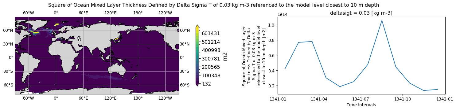
ocean.mlotstsq.tavg-u-hxy-sea.mon.glb
long name: Square of Ocean Mixed Layer Thickness Defined by Delta Sigma T of 0.03 kg m-3 referenced to the model level closest to 10 m depth (m2)
timeseries aggregation method for 3D->1D plot: mean
NorESM->CMOR: mldb04sq -> mlotstsq
history: 2026-06-17T11:50:26Z altered by CMOR: Treated scalar dimension: 'deltasigt'.
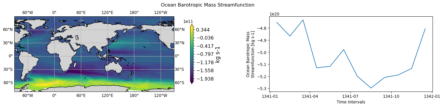
ocean.msftbarot.tavg-u-hxy-sea.mon.glb
long name: Ocean Barotropic Mass Streamfunction (kg s-1)
timeseries aggregation method for 3D->1D plot: mean
NorESM->CMOR: btmstr -> msftbarot
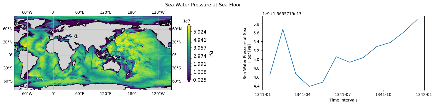
ocean.pbo.tavg-u-hxy-sea.mon.glb
long name: Sea Water Pressure at Sea Floor (Pa)
timeseries aggregation method for 3D->1D plot: mean
NorESM->CMOR: pbot -> pbo
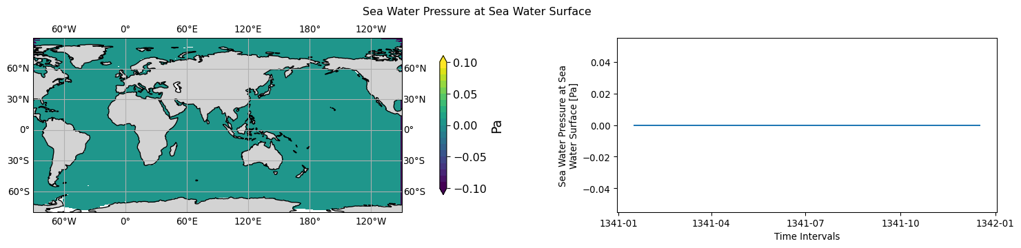
ocean.pso.tavg-u-hxy-sea.mon.glb
long name: Sea Water Pressure at Sea Water Surface (Pa)
timeseries aggregation method for 3D->1D plot: mean
NorESM->CMOR: psrf -> pso
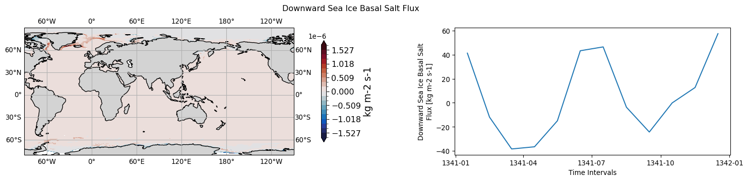
ocean.sfdsi.tavg-u-hxy-sea.mon.glb
long name: Downward Sea Ice Basal Salt Flux (kg m-2 s-1)
timeseries aggregation method for 3D->1D plot: mean
NorESM->CMOR: sfl -> sfdsi
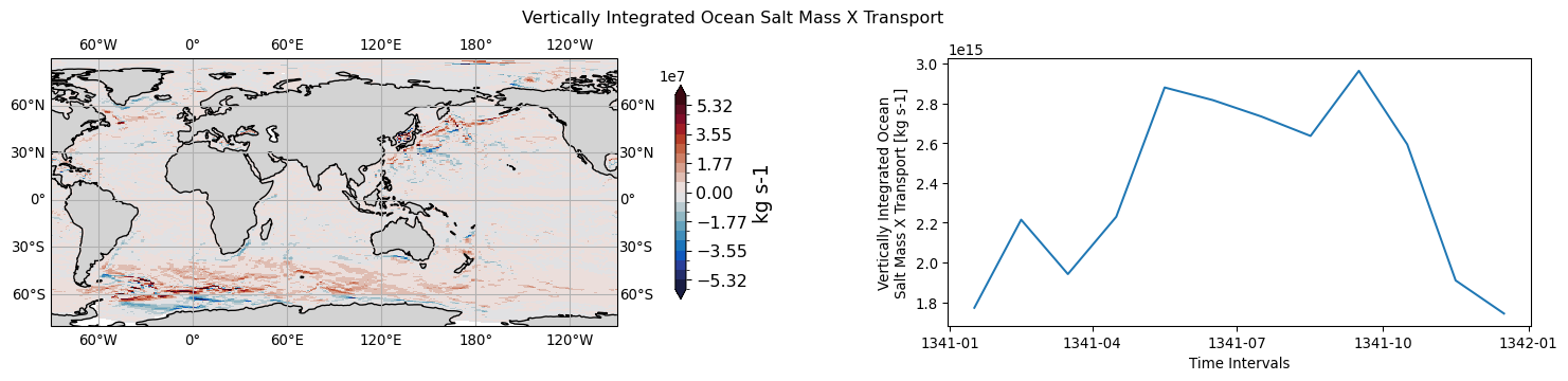
ocean.sfx.tavg-u-hxy-sea.mon.glb
long name: Vertically Integrated Ocean Salt Mass X Transport (kg s-1)
timeseries aggregation method for 3D->1D plot: mean
NorESM->CMOR: usflx, dp -> sfx
history: sfx = vertical average by dp, sum(usflx*dp)/sum(dp)
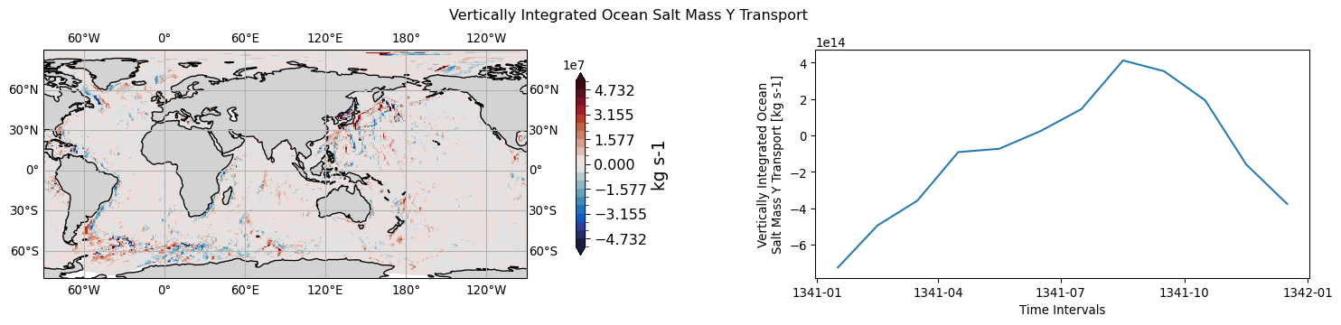
ocean.sfy.tavg-u-hxy-sea.mon.glb
long name: Vertically Integrated Ocean Salt Mass Y Transport (kg s-1)
timeseries aggregation method for 3D->1D plot: mean
NorESM->CMOR: vsflx, dp -> sfy
history: sfy = vertical average by dp, sum(vsflx*dp)/sum(dp)
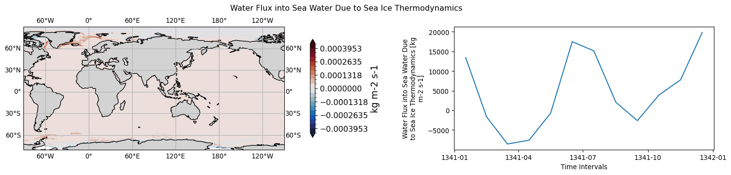
ocean.siflfwbot.tavg-u-hxy-sea.mon.glb
long name: Water Flux into Sea Water Due to Sea Ice Thermodynamics (kg m-2 s-1)
timeseries aggregation method for 3D->1D plot: mean
NorESM->CMOR: fmltfz -> siflfwbot
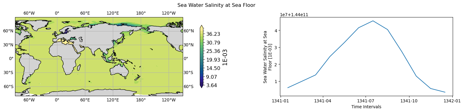
ocean.sob.tavg-u-hxy-sea.mon.glb
long name: Sea Water Salinity at Sea Floor (1E-03)
timeseries aggregation method for 3D->1D plot: mean
NorESM->CMOR: sbot -> sob
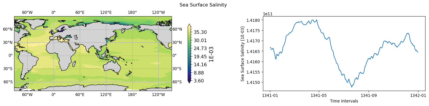
ocean.sos.tavg-u-hxy-sea.day.glb
long name: Sea Surface Salinity (1E-03)
timeseries aggregation method for 3D->1D plot: mean
NorESM->CMOR: sss -> sos
ocean.sos.tavg-u-hxy-sea.mon.glb
long name: Sea Surface Salinity (1E-03)
timeseries aggregation method for 3D->1D plot: mean
NorESM->CMOR: sss -> sos
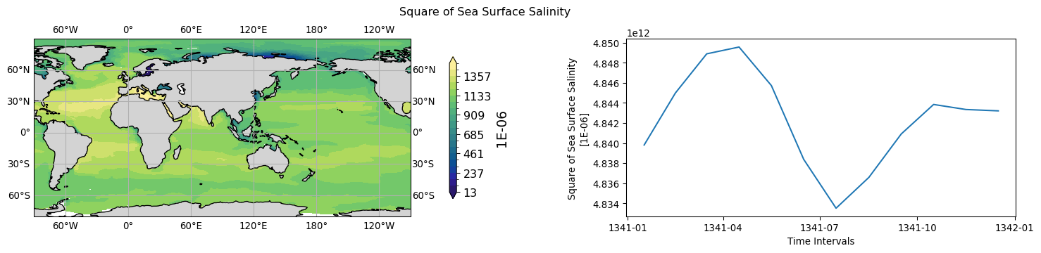
ocean.sossq.tavg-u-hxy-sea.mon.glb
long name: Square of Sea Surface Salinity (1E-06)
timeseries aggregation method for 3D->1D plot: mean
NorESM->CMOR: ssssq -> sossq
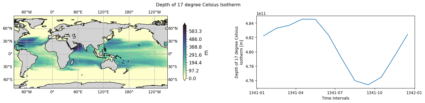
ocean.t17d.tavg-u-hxy-sea.mon.glb
long name: Depth of 17 degree Celsius Isotherm (m)
timeseries aggregation method for 3D->1D plot: mean
NorESM->CMOR: t17d -> t17d
ocean.t20d.tavg-u-hxy-sea.day.glb
long name: Depth of 20 degree Celsius Isotherm (m)
timeseries aggregation method for 3D->1D plot: mean
NorESM->CMOR: t20d -> t20d
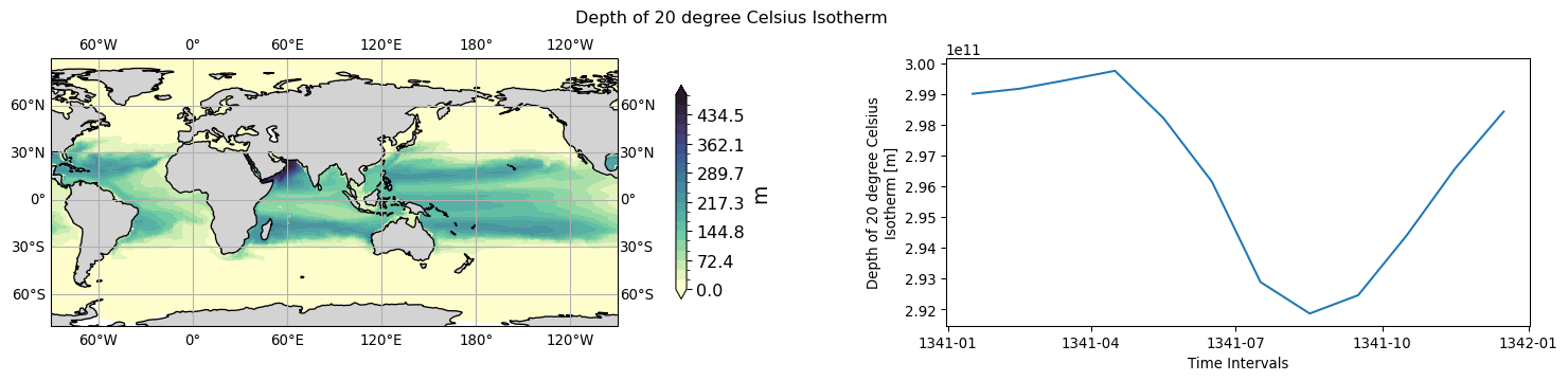
ocean.t20d.tavg-u-hxy-sea.mon.glb
long name: Depth of 20 degree Celsius Isotherm (m)
timeseries aggregation method for 3D->1D plot: mean
NorESM->CMOR: t20d -> t20d
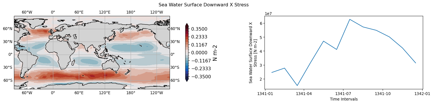
ocean.tauuo.tavg-u-hxy-sea.mon.glb
long name: Sea Water Surface Downward X Stress (N m-2)
timeseries aggregation method for 3D->1D plot: mean
NorESM->CMOR: taux -> tauuo
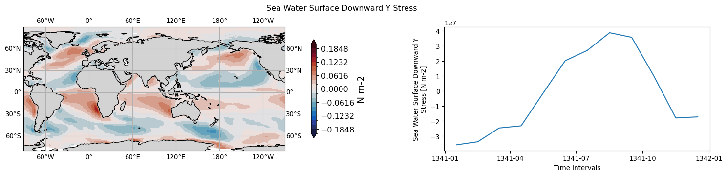
ocean.tauvo.tavg-u-hxy-sea.mon.glb
long name: Sea Water Surface Downward Y Stress (N m-2)
timeseries aggregation method for 3D->1D plot: mean
NorESM->CMOR: tauy -> tauvo
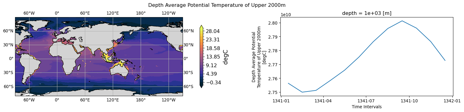
ocean.thetao.tavg-d2000m-hxy-sea.mon.glb
long name: Depth Average Potential Temperature of Upper 2000m (degC)
timeseries aggregation method for 3D->1D plot: mean
NorESM->CMOR: templvl, depth_bnds, pdepth -> thetao
history: thetao = sum(templvl(i,j,k)*(min(2000,pdepth(i,j),depth_bnds(2,k))-min(2000,pdepth(i,j),depth_bnds(1,k)))/sum(min(2000,pdepth(i,j),depth_bnds(2,k))-min(2000,pdepth(i,j),depth_bnds(1,k))) 2026-06-17T11:53:02Z altered by CMOR: Treated scalar dimension: 'depth'.
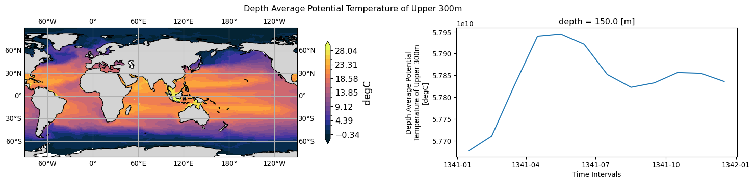
ocean.thetao.tavg-d300m-hxy-sea.mon.glb
long name: Depth Average Potential Temperature of Upper 300m (degC)
timeseries aggregation method for 3D->1D plot: mean
NorESM->CMOR: templvl;depth_bnds;pdepth -> thetao
history: thetao = sum(templvl(i,j,k)*(min(300,pdepth(i,j),depth_bnds(2,k))-min(300,pdepth(i,j),depth_bnds(1,k)))/sum(min(300,pdepth(i,j),depth_bnds(2,k))-min(300,pdepth(i,j),depth_bnds(1,k))) 2026-06-17T11:53:05Z altered by CMOR: Treated scalar dimension: 'depth'.
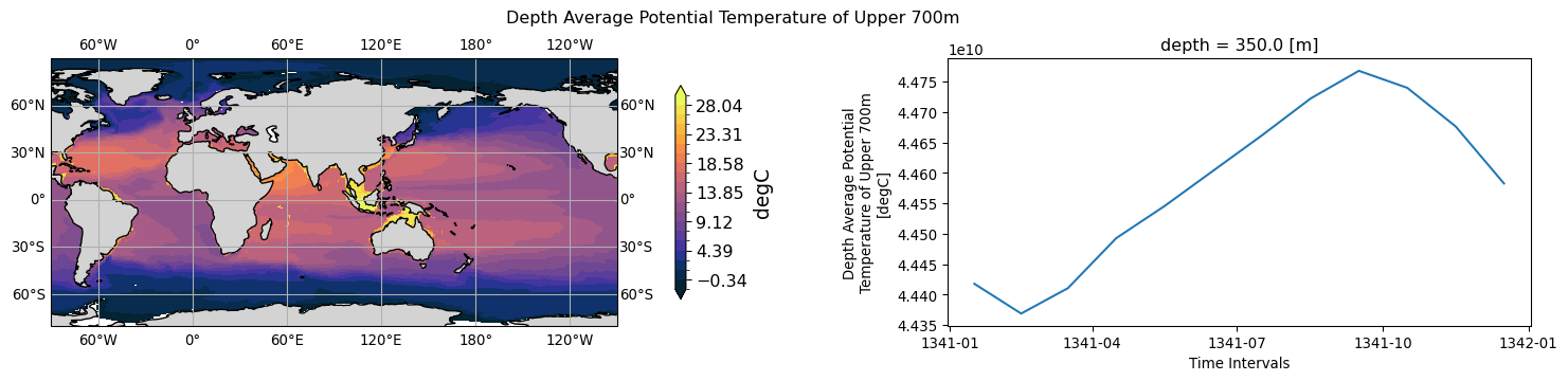
ocean.thetao.tavg-d700m-hxy-sea.mon.glb
long name: Depth Average Potential Temperature of Upper 700m (degC)
timeseries aggregation method for 3D->1D plot: mean
NorESM->CMOR: templvl;depth_bnds;pdepth;pbot -> thetao
history: thetao = sum(templvl(i,j,k)*(min(700,pdepth(i,j),depth_bnds(2,k))-min(700,pdepth(i,j),depth_bnds(1,k)))/sum(min(700,pdepth(i,j),depth_bnds(2,k))-min(700,pdepth(i,j),depth_bnds(1,k))) 2026-06-17T11:53:08Z altered by CMOR: Treated scalar dimension: 'depth'.
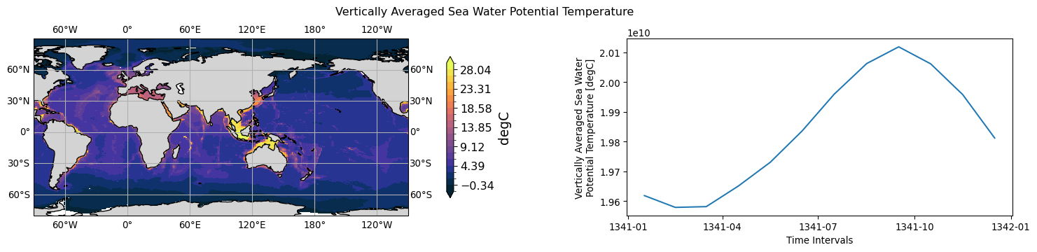
ocean.thetaot.tavg-u-hxy-sea.mon.glb
long name: Vertically Averaged Sea Water Potential Temperature (degC)
timeseries aggregation method for 3D->1D plot: mean
NorESM->CMOR: temp, dp -> thetaot
history: thetaot = sum(temp*dp)/sum(dp)
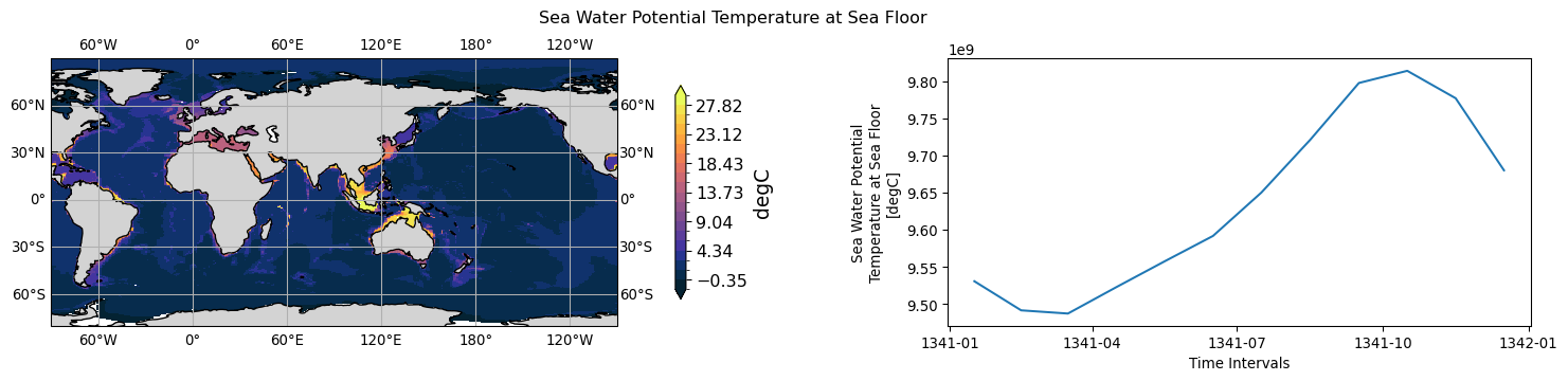
ocean.tob.tavg-u-hxy-sea.mon.glb
long name: Sea Water Potential Temperature at Sea Floor (degC)
timeseries aggregation method for 3D->1D plot: mean
NorESM->CMOR: tbot -> tob
ocean.tos.tavg-u-hxy-sea.day.glb
long name: Sea Surface Temperature (degC)
timeseries aggregation method for 3D->1D plot: mean
NorESM->CMOR: sst -> tos
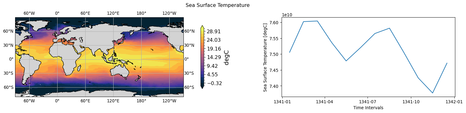
ocean.tos.tavg-u-hxy-sea.mon.glb
long name: Sea Surface Temperature (degC)
timeseries aggregation method for 3D->1D plot: mean
NorESM->CMOR: sst -> tos
ocean.tossq.tavg-u-hxy-sea.day.glb
long name: Square of Sea Surface Temperature (degC2)
timeseries aggregation method for 3D->1D plot: mean
NorESM->CMOR: sstsq -> tossq
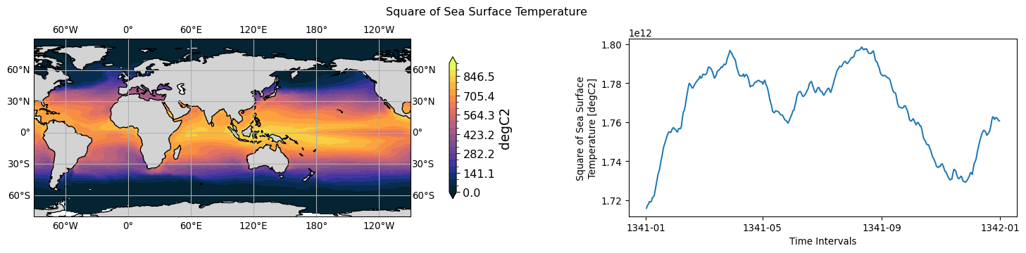
ocean.tossq.tavg-u-hxy-sea.mon.glb
long name: Square of Sea Surface Temperature (degC2)
timeseries aggregation method for 3D->1D plot: mean
NorESM->CMOR: sstsq -> tossq
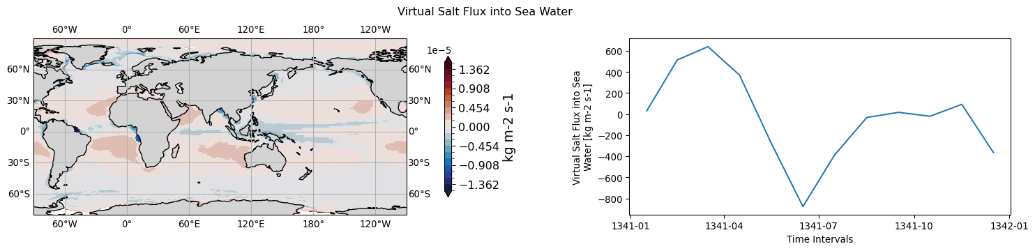
ocean.vsf.tavg-u-hxy-sea.mon.glb
long name: Virtual Salt Flux into Sea Water (kg m-2 s-1)
timeseries aggregation method for 3D->1D plot: mean
NorESM->CMOR: sflx -> vsf
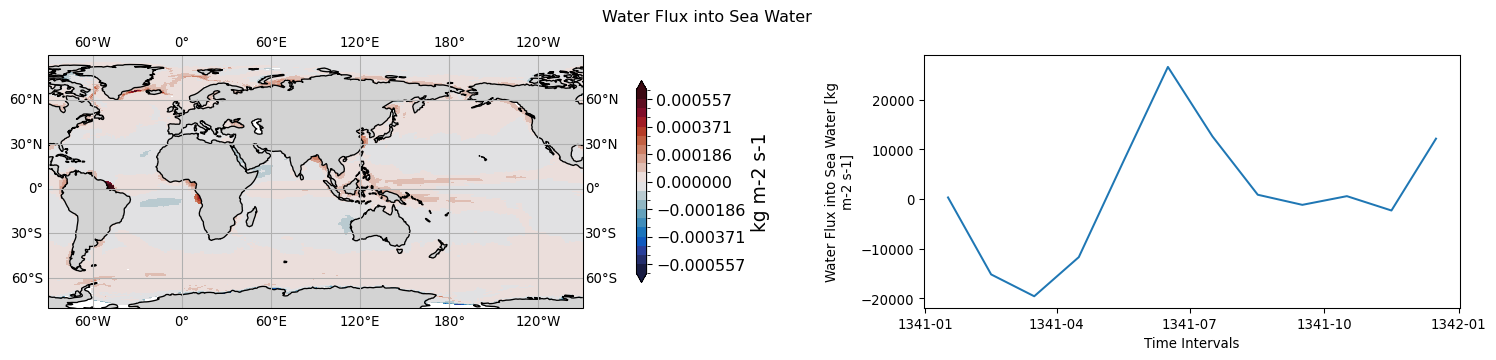
ocean.wfo.tavg-u-hxy-sea.mon.glb
long name: Water Flux into Sea Water (kg m-2 s-1)
timeseries aggregation method for 3D->1D plot: mean
NorESM->CMOR: lip, sop, eva, rnf, rfi, fmltfz -> wfo
history: wfo = lip+sop+eva+rnf+rfi+fmltfz
ocean.zos.tavg-u-hxy-sea.day.glb
long name: Sea Surface Height Above Geoid (m)
timeseries aggregation method for 3D->1D plot: mean
NorESM->CMOR: sealv -> zos
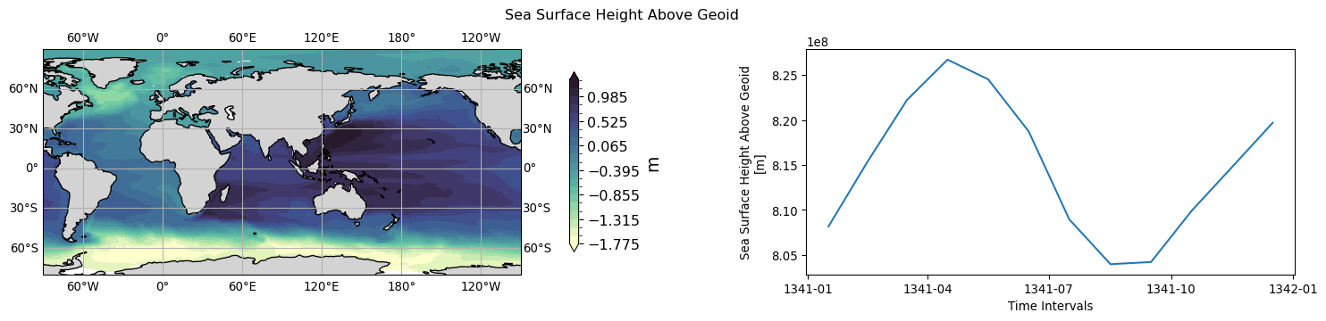
ocean.zos.tavg-u-hxy-sea.mon.glb
long name: Sea Surface Height Above Geoid (m)
timeseries aggregation method for 3D->1D plot: mean
NorESM->CMOR: sealv -> zos
ocean.zossq.tavg-u-hxy-sea.mon.glb
long name: Square of Sea Surface Height Above Geoid (m2)
timeseries aggregation method for 3D->1D plot: mean
NorESM->CMOR: slvsq -> zossq