
ocean: fx#
fx ocean grid data
Branding suffix of datasets
Datasets with the folloing branding suffix are shown in this page:
[time]-[vertical]-[horizontal]-[domain]
ti-u-hxy-sea
ti-u-hxy-u
ti-ol-hxy-sea
ti: time independent
u: ocean surface
ol: ocean levels
hxy: horizontal curvlinear grids
sea: ocean domain
List of datasets:
List of compound names of datasets that needs to be cmorized.
Those datasets which are not cmorized have no link.
ocean.areacello.ti-u-hxy-u.fx.glb
ocean.basin.ti-u-hxy-u.fx.glb
ocean.deptho.ti-u-hxy-sea.fx.glb
ocean.dxto.ti-u-hxy-u.fx.glb
ocean.dxuo.ti-u-hxy-u.fx.glb
ocean.dxvo.ti-u-hxy-u.fx.glb
ocean.dyto.ti-u-hxy-u.fx.glb
ocean.dyuo.ti-u-hxy-u.fx.glb
ocean.dyvo.ti-u-hxy-u.fx.glb
ocean.sftof.ti-u-hxy-u.fx.glb
ocean.thkcello.ti-ol-hxy-sea.fx.glb
ocean.volcello.ti-ol-hxy-sea.fx.glb
Dataset validated:
Each validated dataset has some text information and some plots (2D and/or 1D)
ocean.areacello.ti-u-hxy-u.fx.glb
long name: Grid-Cell Area for Ocean Variables (m2)
original_name: parea -> areacello

ocean.basin.ti-u-hxy-u.fx.glb
long name: Region Selection Index (1)
original_name: region -> basin
history: 2026-10-21T16:07:53Z altered by CMOR: replaced missing value flag (1e+20) and corresponding data with standard missing value (-999). 2026-10-21T16:07:53Z altered by CMOR: Converted type from 'f' to 'i'.

ocean.deptho.ti-u-hxy-sea.fx.glb
long name: Sea Floor Depth Below Geoid (m)
original_name: pdepth -> deptho

ocean.dxto.ti-u-hxy-u.fx.glb
long name: Cell Length in the X Direction at t-points (m)
original_name: pdx -> dxto

ocean.dxuo.ti-u-hxy-u.fx.glb
long name: Cell Length in the X Direction at u-points (m)
original_name: udx -> dxuo

ocean.dxvo.ti-u-hxy-u.fx.glb
long name: Cell Length in the X Direction at v-points (m)
original_name: vdx -> dxvo

ocean.dyto.ti-u-hxy-u.fx.glb
long name: Cell Length in the Y Direction at t-points (m)
original_name: pdy -> dyto

ocean.dyuo.ti-u-hxy-u.fx.glb
long name: Cell Length in the Y Direction at u-points (m)
original_name: udy -> dyuo
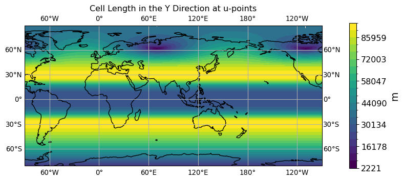
ocean.dyvo.ti-u-hxy-u.fx.glb
long name: Cell Length in the Y Direction at v-points (m)
original_name: vdy -> dyvo

ocean.sftof.ti-u-hxy-u.fx.glb
long name: Sea Area Percentage (%)
original_name: pmask -> sftof

ocean.thkcello.ti-ol-hxy-sea.fx.glb
long name: Ocean Model Cell Thickness (m)
original_name: pdepth, depth_bnds -> thkcello
history: thkcello = min(pdepth(i,j),depth_bnds(k,2))-min(pdepth(i,j), depth(k,1))
vertical aggregation method for 3D->2D plot: sum

ocean.volcello.ti-ol-hxy-sea.fx.glb
long name: Ocean Grid-Cell Volume (m3)
original_name: depth_bnds, pdepth, parea -> volcello
history: volcello = (min(pdepth(i,j),depth_bnds(k,2))-min(pdepth(i,j),depth(k,1)))*parea(i,j)
vertical aggregation method for 3D->2D plot: sum
