ocean: fx#
fx ocean grid data
coordinate: ti-u-hxy-sea
ti: time independent
u: ocean surface
hxy: horizontal curvlinear grids
sea: ocean domain
# Parameters
cmorout = "/scratch/yanchun/cmorout"
source_id = "DUMMY-MODEL"
experiment_id = "piControl"
variant_label = "r1i1p1f1"
grid_label = "g999"
version = "v20260601"
List of data validated:
ocean.areacello.ti-u-hxy-u.fx.glb
ocean.basin.ti-u-hxy-u.fx.glb
ocean.deptho.ti-u-hxy-sea.fx.glb
ocean.dxto.ti-u-hxy-u.fx.glb
ocean.dxuo.ti-u-hxy-u.fx.glb
ocean.dxvo.ti-u-hxy-u.fx.glb
ocean.dyto.ti-u-hxy-u.fx.glb
ocean.dyuo.ti-u-hxy-u.fx.glb
ocean.dyvo.ti-u-hxy-u.fx.glb
ocean.sftof.ti-u-hxy-u.fx.glb
ocean.thkcello.ti-ol-hxy-sea.fx.glb
ocean.volcello.ti-ol-hxy-sea.fx.glb
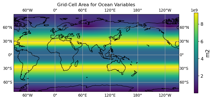
ocean.areacello.ti-u-hxy-u.fx.glb
long name: Grid-Cell Area for Ocean Variables (m2)
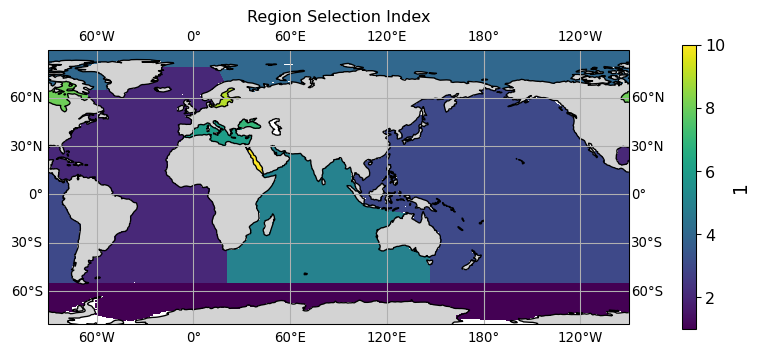
ocean.basin.ti-u-hxy-u.fx.glb
long name: Region Selection Index (1)
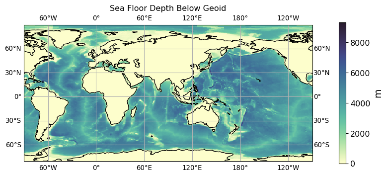
ocean.deptho.ti-u-hxy-sea.fx.glb
long name: Sea Floor Depth Below Geoid (m)
ocean.dxto.ti-u-hxy-u.fx.glb
long name: Cell Length in the X Direction at t-points (m)

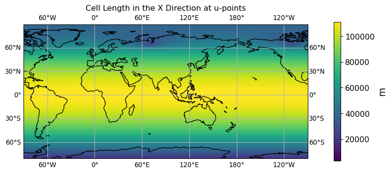
ocean.dxuo.ti-u-hxy-u.fx.glb
long name: Cell Length in the X Direction at u-points (m)
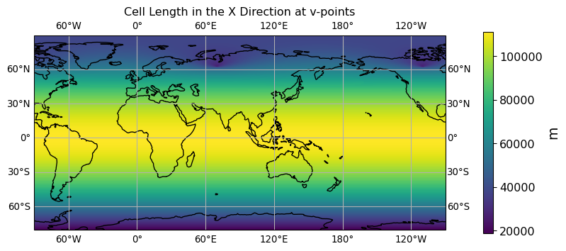
ocean.dxvo.ti-u-hxy-u.fx.glb
long name: Cell Length in the X Direction at v-points (m)
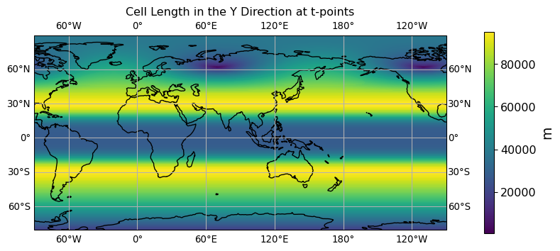
ocean.dyto.ti-u-hxy-u.fx.glb
long name: Cell Length in the Y Direction at t-points (m)
ocean.dyuo.ti-u-hxy-u.fx.glb
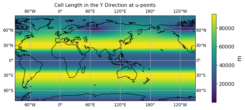
long name: Cell Length in the Y Direction at u-points (m)
ocean.dyvo.ti-u-hxy-u.fx.glb
long name: Cell Length in the Y Direction at v-points (m)

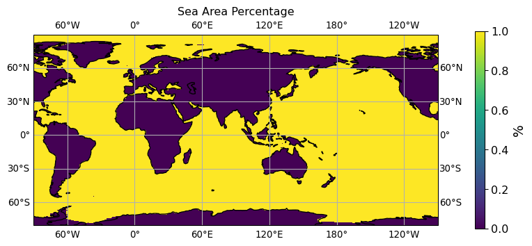
ocean.sftof.ti-u-hxy-u.fx.glb
long name: Sea Area Percentage (%)
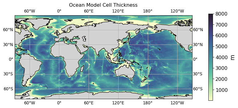
ocean.thkcello.ti-ol-hxy-sea.fx.glb
long name: Ocean Model Cell Thickness (m)
vertical aggregation method for 3D->2D plot: sum
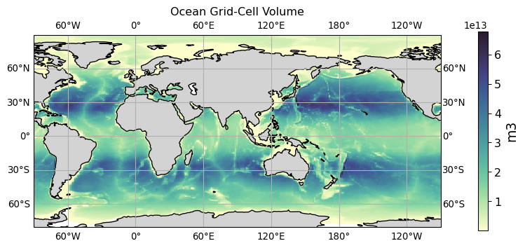
ocean.volcello.ti-ol-hxy-sea.fx.glb
long name: Ocean Grid-Cell Volume (m3)
vertical aggregation method for 3D->2D plot: sum